Last updated: August 2026
The Todra Valley follows the course of the Todgha between Tinghir, the cultivated areas around the town, and the rock formations that lead to the Todra Gorge. The R703 road runs through this corridor and lets you see how the landscape changes over approximately 15 kilometers.
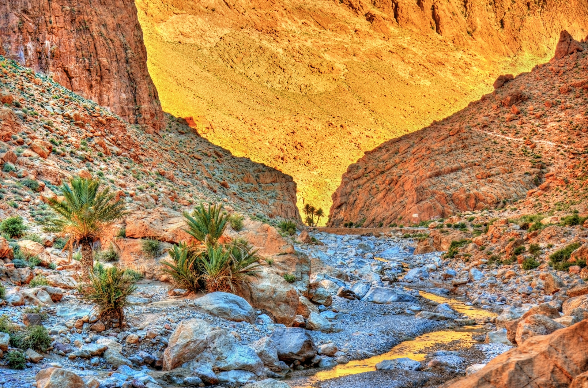
In the early stretches, the valley brings together palm trees, fruit trees, small crops, and buildings close to the cultivated valley floor. As the road heads north, the terrain narrows, the slopes gain presence, and rock walls start to dominate the landscape.
The valley has no single entrance or official sequence of attractions. The experience consists of driving the road at a relaxed pace, choosing safe spots to take in the landscape, and, when there's time, taking a short walk from a known access point.
This article has a different purpose from the dedicated guide to the Tinghir Palm Groves. The palm grove is the oasis's agricultural area; the Todra Valley covers the broader route between Tinghir and the gorge; and the gorge corresponds to the stretch where the canyon walls become narrower and taller.
This guide offers a professional recommendation based on research into the route, the road, and how to organize the visit. The content is not presented as personal experience, since I have not yet visited the Todra Valley.
Quick facts
- Visit time: 1 to 3 hours, including stops
- Location: between Tinghir and the Todra Gorge
- Main road: R703
- Reference distance: approximately 15 kilometers to the best-known stretch of the gorge
- Best time: morning or late afternoon, mainly because of the temperature
- Entrance: no general ticket for driving the road
- Extra costs: a guide, taxi, driver, parking, or private services are charged separately
- Type of visit: scenic drive, viewpoints, and short walks
- Access: paved road, with conditions subject to weather and local work
- Accessibility: the drive itself is simple; stops and walks vary depending on the terrain
Is it worth visiting the Todra Valley?
The Todra Valley is worth visiting mainly for anyone already planning to see the gorge. Instead of treating the 15 kilometers as a quick transfer, you can set aside some time to take in the transition between the cultivated area and the rock formations.
The route helps convey the relationship between water, communities, farming, and terrain. These elements appear gradually during the trip and give context to the narrow canyon stretch visited at the end.
There's no need to stop at every point or turn the route into a full day. One or two viewpoints, a brief walk, and the visit to the gorge form a sufficient plan for most itineraries.
What is the Todra Valley?
The Todra Valley is the area formed along the course of the Todgha, a river or wadi that rises in the High Atlas mountains and crosses different landscapes before continuing into drier regions.
In tourism, the name is usually used for the corridor between Tinghir and the Todra Gorge. Geographically, though, the valley and the watercourse continue beyond this stretch.
How much water is visible changes depending on rainfall, springs, the season, and agricultural use. In some spots there can be running water; in others, the riverbed shows a reduced flow or is dry.
The road follows part of the valley and passes close to farmland, communities, and accommodations. It ends the most common tourist route at the narrow stretch of the gorge, though the R703 continues toward other localities in the High Atlas.
Difference between the valley, the palm grove, and the gorge
The three names describe related parts of the same region, but they don't represent exactly the same attraction.
- Todra Valley: the broader geographic corridor associated with the Todgha's course
- Tinghir Palm Groves: the agricultural area with palm trees, other trees, crops, and channels near the town
- Todra Gorge: a set of limestone canyons, including the narrow stretch visited by most travelers
You can see all three in the same day. The palm grove appears at the start of the route, the valley follows the shift in landscape, and the gorge forms the better-known final part of the tourist route.
How to fit the Todra Valley into your itinerary
A practical plan is to leave Tinghir on the R703, make a first panoramic stop over the cultivated area, and continue toward the gorge.
Along the way, choose only spots where you can park completely off the traffic lane. A short stop is enough to take in the landscape without delaying the rest of the itinerary.
Anyone wanting to walk can use a known access point near an accommodation, a bridge, or a public path. For longer routes between farmland and communities, a local guide helps with orientation and identifying the right paths.
After the stops, continue to the narrow stretch of the Todra Gorge. Set aside separate time to walk through the canyon, since that part has different characteristics from the drive through the valley.
How to get to the Todra Valley
From Tinghir, head north on the R703 road, toward the Todra Gorge. The road is paved and can be driven with a regular vehicle under normal conditions.
The main options are:
- Your own or a rented car: offers the flexibility to stop at safe points
- Taxi: an alternative for anyone not driving
- Driver or transfer: lets you combine the valley with the gorge and other stops in the region
- Bicycle: an option for those used to cycling on roads, after checking the heat, wind, and traffic
- On foot: suitable for specific stretches, not for covering the whole road without planning
- A guided outing: useful for longer walks and information about the region
Download the map for offline use and mark the location of your accommodation, the panoramic points, and the gorge in advance. Cell signal can vary along the route.
Don't count on frequent public transport or fixed schedules between every point in the valley. Anyone without a car can arrange the trip there and back with a taxi, driver, or their accommodation.
Driving the R703
The R703 connects Tinghir to the gorge and continues through the mountains toward other localities. On the most visited tourist stretch, the road is paved and doesn't require a vehicle with special traction under normal conditions.
Drive with attention to pedestrians, bicycles, animals, parked vehicles, and property entrances. Traffic increases near accommodations, restaurants, and the canyon's narrow stretch.
Avoid stopping on bends, bridges, narrow shoulders, or spots that block residents' access. If there's no safe space, continue until you find a wider area.
Heavy rain can change road conditions and increase water flow in the valley and the gorge. Check the forecast and local information when there's weather instability.
Viewpoints and panoramic stops
The valley can be seen from elevated points near Tinghir and from different stretches of the R703. The position of the farmland, the communities, and the rock walls changes along the road.
There's no single mandatory viewpoint. Choose a spot with a safe area to stop, without crossing properties or blocking traffic.
Some hotels, restaurants, and private terraces offer views of the valley. Access can depend on staying there, ordering something, or getting the establishment's authorization.
Morning and late afternoon tend to have more comfortable temperatures. The direction of light varies depending on the point chosen and the time of year.
Communities and the valley's architecture
Along the route there are Amazigh communities, residential neighborhoods, and buildings made of earth, stone, wood, and modern materials.
A ksar is a fortified settlement made up of different homes and communal spaces. A kasbah is usually a fortified residence or a complex tied to a family or authority. The terms don't represent the same type of structure.
Some buildings have been restored, others have been adapted, and many remain in use. The exterior appearance doesn't let you determine precisely the age or function of each building.
Use the streets and public paths. Enter homes, courtyards, terraces, or other buildings only when invited or authorized.
Ask permission before photographing residents, children, interiors, or people at work.
Walks through the valley
A short walk can round out the drive. Prefer known paths and identify in advance where to park and how to get back to the vehicle.
Paths near the river can pass through farmland, channels, private land, and uneven banks. Gates, fences, and crops indicate places that need to be respected.
The river's level and the ground conditions change throughout the year. Don't cross running water, channels, or muddy areas without knowing the depth and stability of the terrain.
For long walks, elevated routes, or connections between different communities, seek local guidance and consider hiring a guide.
The Todgha River and water conditions
The Todgha can have running water in some stretches and a reduced flow in others. The situation depends on rainfall, springs, the season, and how the water is used for farming.
Don't plan swimming or crossing the river as a standard part of the outing. The depth, current, and water quality can change.
During periods of intense rain, narrow parts of the valley and the gorge become more vulnerable to a rapid rise in flow. Postpone walks near the riverbed when there's a weather alert or local guidance to do so.
Tickets and costs
There's no general ticket for driving the R703, viewing the valley from public areas, or continuing to the Todra Gorge.
Guides, taxis, transfers, bike rentals, parking, and private access are charged separately. Since these services don't follow a fixed rate, check the price in Moroccan dirhams and agree on the total before starting.
Private establishments may charge for parking, ordering something, or terrace access. Check the conditions before using the space.
How long to spend
Without stops, the drive from Tinghir to the best-known stretch of the gorge usually takes about half an hour, depending on traffic and your starting point.
With a viewpoint and a short walk, set aside between 1 and 2 hours before entering the canyon. To include a longer walk or several stops, consider about 3 hours.
Time for walking inside the Todra Gorge should be calculated separately. If your itinerary continues to another town the same day, keep a margin for the next stretch of road.
Best time of day to visit
Morning offers milder temperatures and leaves more time to combine the valley with the gorge. It can also be useful for anyone continuing their trip after Tinghir.
Late afternoon works better for travelers staying in the region. Plan your return so you're not relying on farm paths or unlit stops after dark.
In summer, cut down on walking during the hottest hours. Shade varies along the valley and isn't present at every viewpoint or stretch of road.
Best season to visit
Spring and fall tend to have more comfortable temperatures for driving, walking, and spending time at the viewpoints.
Summer can bring intense heat, especially in open areas. In winter, mornings and nights can be cold, despite milder afternoons.
The vegetation, the crops, and how much water is visible change throughout the year. Each season gives the valley a different look.
Before traveling during periods of heavy rain, check conditions on the R703 and in the gorge.
Safety
- Park only in wide areas, off the traffic lane
- Don't stop on bends, bridges, or narrow shoulders
- Wear your seatbelt for the whole drive
- Slow down near communities and businesses
- Watch for pedestrians, bicycles, and animals
- Download the map for offline use
- Bring water, a hat, and sun protection
- Wear closed shoes for walks
- Avoid the riverbed during rain or a weather alert
- Head back before dark when taking a walk
Accessibility
The R703 route can be done by car, letting you see much of the landscape without a long walk.
Accessibility at the viewpoints varies. Some points are close to the road, while others have rocks, dirt, steps, or level changes.
Walks near the river and farmland generally don't have regular ground, handrails, or accessible signage.
Anyone who needs a simpler stop can ask their accommodation or driver about points near the road with a safe drop-off area.
Practical tips
- Leave Tinghir with enough time for a few stops
- Confirm you're following the R703
- Choose only safe spots to park
- Don't block house or property entrances
- Bring water and sun protection
- Wear closed shoes
- Download the map for offline use
- Ask before photographing residents
- Respect gates, fences, and cultivated areas
- Agree on the price for guides and transport in advance
- Check the forecast when rain is possible
- Set aside a separate period for walking in the gorge
Final tip
Leave Tinghir on the R703 and drive the valley without rushing, choosing one or two safe stops to see how the landscape changes between the cultivated area and the rock walls.
If there's time, add a short walk from a known access point. Then continue to the Todra Gorge and set aside a separate period to explore the narrow canyon stretch.
The Todra Valley works best as part of the trip between Tinghir and the gorge. The route becomes more interesting when it stops being just a transfer and starts showing the relationship between the river, farming, communities, and terrain.