Last updated: August 2026
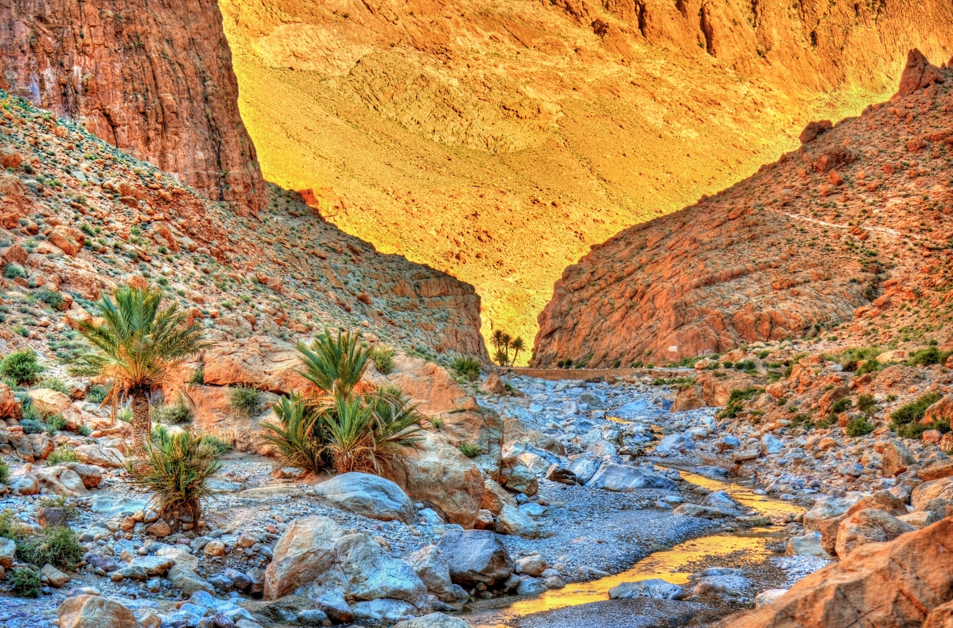
The Todra Gorge forms a limestone rock corridor in the eastern High Atlas, near Tinghir. In the most visited area, the walls close in on the road and create a narrow passage used by pedestrians, vehicles, and residents of the communities further ahead.
The Todra, also spelled Todgha, runs through the valley before entering the mountains. Water, erosion, and geological movement helped shape the gorge, whose walls reach great heights at different points.
The standard visit doesn't require a technical trail. You can arrive by car or taxi, walk through the narrow section, and return the same way. Climbing and routes into the upper areas call for separate planning.
Quick facts
- Visit time: approximately 1 to 2 hours
- Location: about 15 kilometers north of Tinghir
- Type of attraction: canyon, short walk, scenery, and climbing
- Entrance: free
- Hours: natural area with no official opening hours
- Main route: walking the road through the narrow section
- Difficulty: easy for the basic walk
- Best time of year: spring and fall, with milder temperatures
- Accessibility: possible in part, but limited by traffic, uneven ground, and water
- Caution: avoid the canyon during heavy rain or flash flood risk
Is it worth visiting the Todra Gorge?
It's worth it for anyone traveling through the region between Ouarzazate, the Dades Valley, and Merzouga. The narrow section is easy to reach and lets you take in the canyon walls without a long walk.
The experience depends on the time of day and the crowds. Buses, cars, vendors, and tour groups can occupy part of the passage, especially during busier periods.
Anyone with just a few minutes can cross the main section on foot and head back. With more time, you can continue along the road, walk the surrounding area, or arrange climbing activities with local professionals.
What is the Todra Gorge?
The Todra Gorge is a sequence of canyons formed by the course of the Todra River in the eastern High Atlas. The river and its seasonal flows cut through layers of limestone and helped shape the walls and passages seen today.
The best-known part corresponds to the last few hundred meters of the narrow corridor. Some references put the width at close to 10 meters at the tightest points, but the distance between the walls varies along the route.
There are also differences between the published height figures. Some parts of the gorge system are described with walls close to 300 meters, while smaller estimates appear for the narrow stretch. So these dimensions should be understood as approximations, not uniform measurements.
Todra or Todgha?
Todra and Todgha are spellings used for the same river, valley, and set of gorges. In French, "Gorges du Todgha" is common, while maps and guides also use "Todra Gorge."
Both forms can appear on signs, accommodations, and tourist services. This variation doesn't refer to different attractions.
What's the difference between the Todra Valley and the gorge?
The Todra Valley extends from Tinghir and includes the river, cultivated land, palm groves, villages, and the road toward the mountains.
The Todra Gorge is the part where the terrain closes in and the rock walls form the canyon. During the trip from Tinghir, the landscape gradually shifts from the more open valley to the narrow passage.
Both areas are part of the same route, but they offer different experiences. The valley shows the relationship between water, agriculture, and communities; the gorge concentrates the more dramatic geological scenery.
How to get to the Todra Gorge
The main base is Tinghir. From the city, head north on the road that follows the Todra Valley to the gorge entrance. On road maps, the route may appear linked to the R703.
- By car: approximately 15 kilometers from Tinghir, with travel time varying based on traffic and stops
- By petit taxi or grand taxi: agree on the price, wait time, and return trip before setting out
- With a driver or tour: confirm how much time will be set aside for walking
- By bicycle: possible for anyone prepared for the incline, heat, and vehicle traffic
The road continues past the narrowest area and serves villages located in the mountains. So it doesn't function only as tourist access.
How the visit works
The basic visit is self-guided. After reaching the narrow section, walk the road between the walls and turn back whenever you like.
There's no monumental entrance, turnstile, or single official route. The area has accommodations, cafés, vendors, and points where vehicles stop or slow down.
Since cars, motorcycles, and buses pass through the canyon, walk to the side and stay alert even while taking photos.
The watercourse varies throughout the year. In dry periods there may be just a small flow; after rain or snowmelt in the mountains, the water's level and force can increase.
Walking the narrow section
The simplest outing is crossing the narrow section along the road. The route is relatively flat and doesn't require technical gear.
Take time to look at the walls, the rock layers, and the changing light. The narrowest area isn't long, so you don't need to walk for hours to see the main scenery.
The ground can have stones, wet patches, and uneven spots. Wear shoes with good grip and avoid blocking the path of vehicles or other visitors.
Trails in the surrounding area
There are hikes that climb the nearby areas and cross terrain above the gorge. These routes are different from the basic walk along the road.
Duration, difficulty, and the path itself vary. Some routes lack continuous signage and can pass through isolated areas or areas close to local communities.
Hire a local guide if you want to do a long hike, especially when there's no clearly defined route. Bring water, sun protection, and information about the terrain conditions.
Rock climbing at the Todra Gorge
The limestone walls make the Todra Gorge one of Morocco's best-known climbing destinations. There are routes of different lengths and difficulty levels.
Climbing isn't part of the standard tourist visit. The activity requires experience, proper equipment, knowledge of the routes, and an assessment of the rock conditions and protection.
Beginners should hire a qualified guide or instructor. Confirm what's included in the service, such as helmet, harness, ropes, footwear, transport, and insurance.
Don't try to climb walls, boulders, or technical sections just to take photos. Rockfall and aging bolts on old routes should also be taken into account.
Tickets and parking
There's no official ticket for walking through the public part of the Todra Gorge.
There's also no single public parking rate that applies to the whole area. Vehicles can park in spaces near hotels, cafés, or private businesses, where conditions and charges vary.
Before leaving your car, confirm whether the area is public or private and ask for the total price. Don't confuse a parking, guide, or other service charge with a mandatory ticket for the canyon.
How long to spend
- Quick stop: approximately 30 to 45 minutes
- Relaxed walk through the narrow section: between 1 and 2 hours
- Continuing along the road or hiking nearby: half a day
- Climbing: half a day or a full day, depending on the activity
On organized itineraries, confirm how long the stop will be. Some tours only stay long enough for photos.
Best time to visit
Direct light reaches different parts of the canyon depending on the sun's position and the time of year. Around midday, some walls and parts of the canyon floor can get more light, but that can also be a busier period.
In the morning, the temperature tends to be more pleasant and visitor numbers can be lower. In the late afternoon, part of the canyon stays in shadow and the light disappears earlier between the walls.
For photography, adjust your timing to the kind of image you want. Shade helps with walking in the heat, while more direct light reveals the colors and details of the rock.
Best season to visit
Spring and fall tend to offer milder temperatures for walking. In summer, the shade inside the canyon helps, but the trip there and the open areas can get very hot.
In winter, mornings and nights can be cold. Snow and weather changes in the upper areas of the High Atlas can also affect roads and outdoor activities.
Whatever the season, check the forecast for Tinghir and the mountains before entering the canyon.
Accessibility
The road through the main section is relatively flat and allows vehicle access. However, there's no continuous accessible infrastructure across the whole area.
Uneven ground, stones, water, traffic, and the lack of sidewalks can make the route difficult for people with reduced mobility or wheelchair users.
Anyone needing to avoid long walks can still take in part of the walls from the areas reachable by car. Assess the conditions on the day of the visit.
Safety and flash flood risk
Canyons can experience flash floods even when the rain falls in higher, more distant areas. Don't enter or stay in the gorge during heavy rain, a storm forecast, or a local closure notice.
After rain, the volume of water, slippery ground, and rockfall can increase the risks. Never cross a flooded area just because other vehicles are attempting to pass.
For hiking, canyoning, or climbing, ask local professionals about weather, route conditions, and the equipment needed. The standard walk along the road shouldn't be confused with technical activities.
Practical tips
- Wear shoes with good grip
- Bring water and sun protection
- Walk to the side and watch for traffic
- Don't pay a charge presented as an official ticket for the canyon
- Confirm any parking fee in advance
- Check the weather forecast for the mountains
- Don't go in during heavy rain or flash flood risk
- Hire professional guidance for climbing or long hikes
- Respect private property and local communities
- Take your trash back with you
Final tip
Make the trip from Tinghir with enough time to take in the shift between the palm grove, the valley, and the rock walls. When you reach the narrow section, park only where allowed and walk the corridor on foot.
One or two hours is enough for the basic visit. Only continue on to hiking or climbing with proper planning, and postpone the outing if there's heavy rain or flash flood risk in the mountains.