Last updated: August 2026
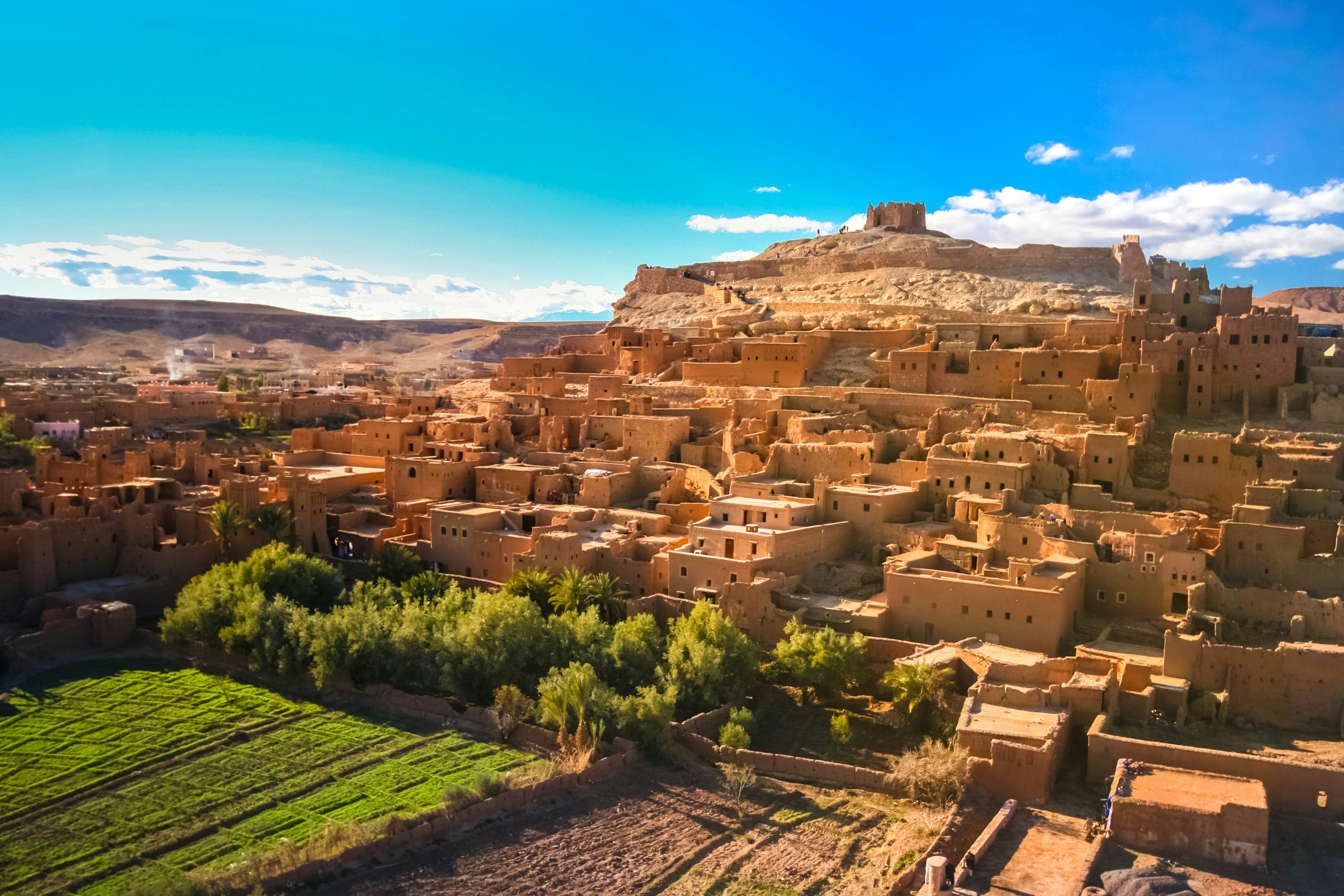
The hilltop at Ait Ben Haddou offers a different perspective from the one seen across the Ounila River. During the climb, the ksar's towers and rooftops appear in the foreground; near the top, the view opens onto the valley, the modern village, and the mountainous terrain around it.
The path starts in the ksar's internal passageways and climbs through ramps, steps, and stretches of earth or stone. The distance is not long, but uneven ground, the incline, and the heat can make the walk more tiring than it looks.
At the highest point stand the remains of a fortification and a structure traditionally associated with communal storage. The elevated position helps explain how Ait Ben Haddou was laid out on the hillside and how the settlement related to the old routes through the Ounila Valley.
Quick facts
- Time needed: approximately 45 minutes to 1 hour to climb, take in the view, and descend
- Location: upper section of Ksar Ait Ben Haddou
- Starting point: internal passageways near the ksar entrance
- Type of route: uphill walk over ramps, stones, and steps
- Difficulty: moderate for anyone used to walking
- Entrance: no separate official charge specific to the viewpoint
- Extra costs: private interiors or a guide may be charged separately
- Best time: morning or late afternoon, mainly because of the heat
- Shade: limited along part of the climb
- Accessibility: unsuitable for wheelchairs and difficult for anyone with reduced mobility
Is it worth climbing to the top?
The climb is worth it for anyone able to walk on uneven ground who wants to see Ait Ben Haddou from another angle. From up top you can make out the rooftops, the internal passageways, the modern village, and the layout of the Ounila Valley.
The opposite bank of the river gives the fullest view of the ksar's silhouette, while the hilltop shows how the buildings occupy the different levels of the hillside. Anyone who cannot reach the top will still find good views along the way.
What is at the top of Ait Ben Haddou?
UNESCO records a fortification and a storage-related space at the top of the settlement. The site is generally identified as an old fortified communal granary, also called an agadir.
What remains today are earthen structures, not a complete tower or a modern platform. The main draw is the elevated position and the view over the valley. Stay on the path and avoid climbing onto walls or fragile sections.
How to get to the top
After crossing the footbridge and entering the ksar, follow the passageways that climb the hillside. The route crosses the lower section and continues between the buildings up to the highest point.
Some forks lead to shops, homes, or private areas. Watch for signs and ask if you are unsure. Hiring a guide is not required, but a guided visit can make navigation easier and add historical context.
The climb usually takes between 15 and 30 minutes, depending on pace and stops. Allow a similar amount of time for the way down.
What is the path like?
The path combines earthen ramps, stones, steps, and narrow passages. Some stretches are steep or have loose sections, so wear sturdy shoes and watch your footing.
There are intermediate points where you can rest and look out over the rooftops or the valley. After rain, the ground can become slippery and require extra care.
What can you see from the top?
Looking toward the lower ksar, you can make out the towers, the passageways, and the different levels of building on the hillside. Across the river sits the modern village, where places to stay, restaurants, and parking are concentrated.
The Ounila Valley stretches around the settlement, with cultivated areas and rises linked to the High Atlas in the background. Water levels, vegetation, and mountain visibility change with the season and the weather.
Best spot for photos
The points near the top let you photograph the rooftops and towers with the valley behind them. To frame the whole of Ait Ben Haddou, the opposite bank of the river remains the best position.
Look for the angles available along the path, and do not climb onto walls or fragile structures to take a photo.
Tickets and costs
There is no official ticket specific to climbing to the top. Private interiors and guided visits may be charged separately.
Before entering a property or hiring a service, confirm the price in Moroccan dirhams.
How long to spend
Set aside 45 minutes to 1 hour to climb, take in the view, and descend. The time varies with pace and any stops for rest or photography.
To see the rest of the ksar and fit in the climb without rushing, plan for 2 to 3 hours at Ait Ben Haddou.
Best time to climb
Mornings bring cooler temperatures, while late afternoon can bring out the colors of the buildings and the valley. If you choose the end of the day, start heading down before dark.
In summer, avoid the hottest hours, since there is little shade along part of the route.
Accessibility and physical effort
Steep ramps, stones, steps, and uneven ground make the climb difficult for anyone with reduced mobility. There is no elevator, transport to the top, or handrails along the entire path.
Anyone unable to complete the climb will still find partial views from the lower areas and can see the ensemble from the opposite bank. Children should stay supervised on the higher stretches.
Safety and preservation
- Wear sturdy shoes and watch your footing on the way down
- Carry water and sun protection
- Do not climb onto walls, roofs, or fragile structures
- Keep your distance from unprotected edges
- Respect private areas and ask permission before photographing residents
Final tip
Make the climb after walking through the ksar's main passageways. Seen from above, the layout of the towers, rooftops, and paths on the hillside becomes easier to follow.
Set aside about an hour and take advantage of the intermediate points too. After descending, view Ait Ben Haddou from the opposite bank of the river: the hilltop shows the internal layout, while the outside view reveals the whole ensemble on the hill.